Madeira
Subtropical volcanic jewel with hanging laurel forests and dizzying ocean levada walks.
Geographic Essence & What Makes It Unique
Rising abruptly out of the deep Atlantic 600 kilometers off the Moroccan coast, Madeira is an island of eternal spring. Centuries of ingenuity created the "levadas"—an ingenious 2,000-kilometer network of stone aqueducts carved into cliff faces to channel water from high peaks down to coastal terraces. Walking these paths takes travelers directly through the UNESCO-protected ancient Laurisilva forest, where giant ferns and ancient laurels drape mist-shrouded canyons.
Concrete Landmarks & Terrains to Explore
Pico do Arieiro to Pico Ruivo
The island's premier mountain path connecting its third-highest and highest summits above sea-of-clouds inversions.
Fanal Ancient Forest
Ghostly, moss-covered Ocotea foetens stinkwood trees standing in rolling highland pastures often enveloped in ethereal fog.
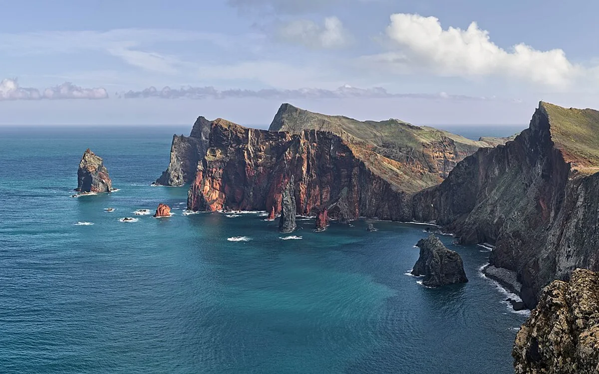
Ponta de São Lourenço
A long, arid volcanic peninsula of red and ochre basalt bluffs extending into the open Atlantic.
Cabo Girão Skywalk
A glass-floored viewing platform suspended 580 meters above crashing surf on one of the highest sea cliffs in Europe.
Core Exploration Experiences
- Hike the high mountain traverse from Pico do Arieiro to Pico Ruivo across narrow stone staircases.
- Follow tranquil levada walks through tunnels and waterfalls such as Levada das 25 Fontes.
- Witness dramatic waves crashing against the raw volcanic sea cliffs of Ponta de São Lourenço.
- Bathe in the natural volcanic rock swimming pools of Porto Moniz fed directly by ocean swell.
Seasonality & Optimal Travel Months
Pleasant year-round due to the maritime climate. April to October bring the driest hiking weather and lush flowers; winter is greener with occasional mountain rain.
Balanced Editorial Assessment
Key Advantages
- Mellow, spring-like climate that avoids severe temperature extremes throughout the entire year.
- Vast and varied walking trail system adapted to all fitness levels along flat levadas or jagged crests.
- Compact island dimensions with modern tunnels facilitating easy day exploration from one base.
Drawbacks & Real Challenges
- Steep, narrow mountain roads require confident driving; mountain fog and rockfall can occur after heavy rain.
- Natural sandy beaches are scarce; coastal swimming is mostly conducted in rocky coves or ocean lidos.
- Popular trails like Pico do Arieiro now require advance registration and parking management to control congestion.
Field Notes & Planning Intelligence
- Bring a reliable headlamp and waterproof shell jacket for walking through unlit, dripping levada tunnels.
- Rent a car with sufficient engine torque for negotiating steep 20%+ gradients outside Funchal.
- Check real-time webcams (NetMadeira) before driving into the mountains to verify cloud inversion conditions.
Comparable Geographic Alternatives
Verified Research Sources
This profile was verified using records from primary government, conservation, and meteorological bodies.
- Madeira Tourism Official Board — Levada trail statuses, safety warnings, and public mountain transport schedules.
- Instituto das Florestas e Conservação da Natureza (IFCN) — Environmental protection zones, natural park permits, and trail conservation.
- Instituto Português do Mar e da Atmosfera (IPMA) — Microclimate data comparing humid northern slopes to dry southern coast.